Content:
Haglöf Laser Geo 3D Pile
Share by:
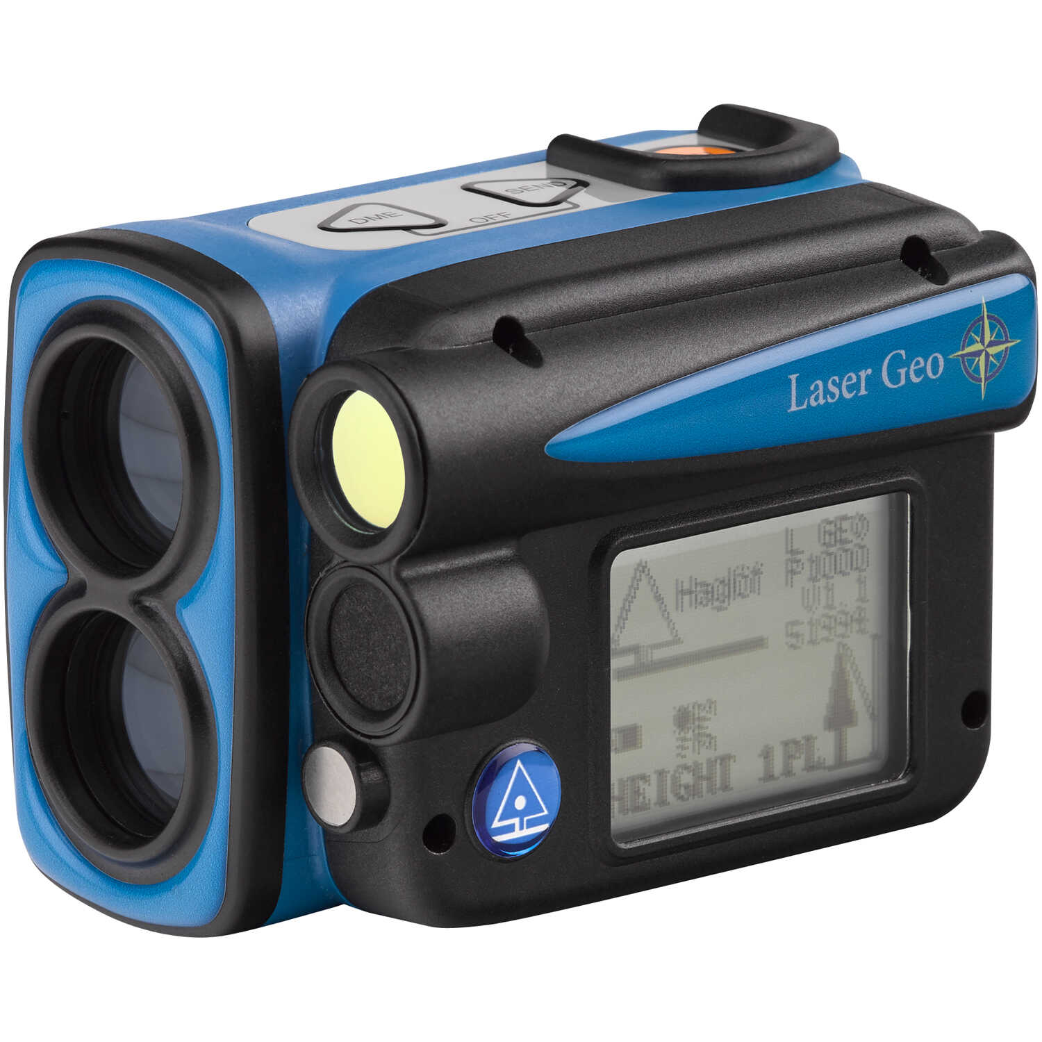
Use to keep track of the size of your inventory! With a series of simple measurement operations, advanced calculations are performed as a one-person, single instrument job. The Laser Geo 3D Pile offers outstanding capacity and versatility for accurate and efficient field measurement work in different situations, terrains, climates and surroundings. Results can be stored or transferred to a PC or handheld device with USB, Bluetooth or IR communication. Keep track of log pile volume, wood chip piles, gravel or aggregate mounds and more. The 3D Pile software allows multiple types of piles to be measured while creating a three-dimensional image of the object. Measurement results are available in the field using your smart phone or tablet, or data can be opened directly into Google Earth (requires internet access). Using the Pits and Piles 3D Cloud Service, you can calculate, edit, store and print all of your measurements from your web browser. The Laser Geo measures in open terrain and for distance measuring from 18˝ up to 2,296´. It can also be used to measure tree heights and canopy, to map areas and trails, to measure terrain slopes, to store and process collected data, plus it includes built-in GPS and compass. The Laser Geo can be custom programmed, updated, and upgraded.
 WARNING: Cancer and Reproductive Harm - www.P65Warnings.ca.gov.
We encourage our customers to let us know what experiences they have had with our products, whether good or bad. By submitting a review, you can share your experiences with others and also provide valuable feedback to us as well. With just a few simple steps, you can add your review of this product.
 Have A Question About This Product?